Throughout 300,000 years of human history, only twelve people (out of the estimated 100+ billion humans that have ever lived) have set foot on the Moon. From Neil Armstrong in 1969 to Eugene Cernan in 1972, this monumental feat of engineering and human innovation has remained unmatched for over 50 years. Despite the radical advances in technology since the last manned landing on the lunar surface, only five[JP1] landers have managed to successfully touch down on lunar soil since the end of NASA’s Apollo program, all of them unmanned. As Peregrine returns America to the Moon after so many decades, it’s important to understand why landing on the lunar surface is so difficult:
Even Getting Something into Space Is Extremely Hard
If you’ve read our post on <”why it is so difficult to explore outer space”> you’re well aware of how difficult it is to even get a spacecraft out of Earth’s atmosphere, let alone the extra ~238,000 miles to reach our closest neighbor the Moon. For those of you that need a refresher: rockets are both cost-conscious and very bumpy; space is way too hot, way too cold, and full of deadly radiation and high-speed pebbles, all of which could wreak havoc on your spacecraft if you’re not prepared; and failure to account for any possible problem you might encounter while cruising through the great void will leave you stranded with no one to help you make it the rest of the way, or make it back to Earth, in one piece.
Let’s assume for the sake of argument that you’ve read our previous post very carefully, taken all its lessons to heart, and have managed to navigate a robotic lander into orbit around the Moon. Great job! Hopefully you’ve thought about the first challenge of touching down on the surface: figuring out where exactly your spacecraft is.
Dude, Where’s My Lander?
Maya Angelou once said, “You can’t really know where you’re going until you know where you’ve been.” This wisdom holds true for both people making their way through life and spacecraft attempting a Moon landing.
Accurate, precise readings of a spacecraft’s location, velocity, and orientation in lunar orbit are vital to a successful landing attempt because a lander’s Guidance Navigation and Control (GNC) computer systems use these initial data points to properly adjust course. A lander tracks and monitors this data using a variety of onboard sensors. Radar aimed at the lunar surface can reliably measure a spacecraft’s altitude and velocity. Spacecraft orientation can be determined using internal gyroscopes or cameras pointed at the stars to calculate what direction the topside of the lander is pointing. This vital data is stored onboard the lander itself but is also transmitted back to Earth to the Mission Control Room where the operators will track the lander’s progress and transmit commands for it to adjust itself according to the mission plan. Once the lander is in the right spot in its orbit, operators will send the command to initiate the landing sequence, at which point the spacecraft will start firing its main engines to slow itself down and begin its descent.
This may sound straightforward, but there are a variety of challenges at this stage of the mission. Sensors can fail for a multitude of reasons such as software errors, hardware faults caused by debris or a micrometeorite impact, or malfunctions caused by components overheating, freezing, or suffering a power failure. Should a sensor malfunction not have back-up or redundant system to compensate for the breakdown, there will be no way to accurately gather this essential data. Providing the lander this information from Earth is not feasible because the vast distance to the Moon and the miniscule size of spacecraft makes accurate measurements either painfully difficult and too slow to be useful for the mission or simply not possible. Even if that was practical, a disruption in the communication relay between the lander and Mission Control (in addition to the unavoidable 2.5 second lag due to how long it takes for radio signals to be sent to the Moon and back) would be enough to jeopardize the mission.
With careful design of your spacecraft and planning of your mission (not to mention some good luck) you will have fully functional sensors, seamless communication with your lander, and accurate data on its location from Mission Control on Earth. But before you transmit the command to initiate “Land_on_Moon.exe” you and your lander must face another challenge: deciding where to touch down.
The Moon: A Big Empty Parking Lot
Choosing the right location to land your spacecraft on the Moon is crucial to your mission’s success, and the ideal landing site will depend on what kind of mission goals your spacecraft is designed to achieve.
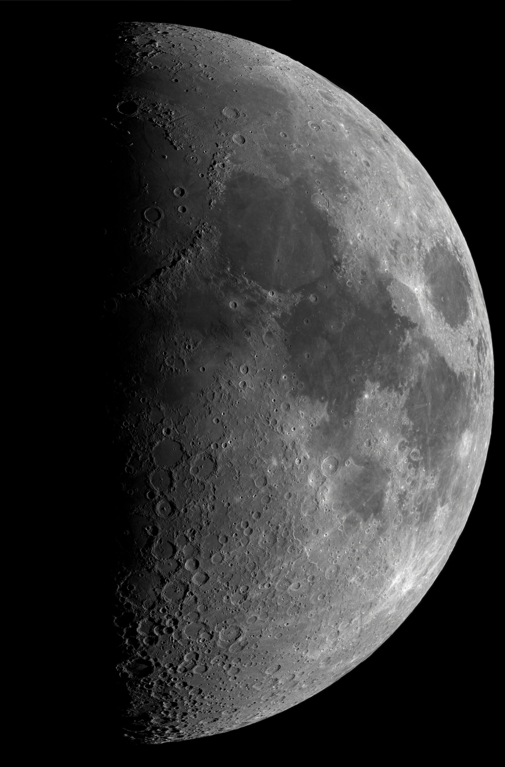
Although it lacks an atmosphere or any known life on its surface, the Moon hosts wide variety of terrain types including highlands and lowlands, elevated ridges, crater rims and valleys, mountain ranges formed by ancient lunar volcanoes, and vast rocky plains known as “lunar seas” because their darker shade of gray give the impression of oceans when viewed from Earth. Each of these terrains offer their own unique benefits, scientific opportunities, and hazards to a lunar lander.
Whether a landing site is near the lunar equator, one of the lunar poles, or somewhere in between is also vital to consider. Just as it does on Earth, the path the sun takes across the sky will vary based on lunar latitude; locations near the equator will have the sun arcing directly overhead, which is better suited for solar panels mounted on top of a lander, while polar locations will have the sun circling low around the horizon, a better fit for solar panels wrapped around the sides of a spacecraft.
Even more critical for your mission to the Moon is what side of the Moon you choose to land on. The Moon is “tidally locked” with the Earth, which means that the time it takes the Moon to spin once around its own axis is equal to the time it takes to complete one orbit around the Earth. This unique feature of the Moon’s orbit means that the same side of the Moon is permanently facing towards Earth (the nearside), and one side is permanently facing away from Earth (the farside). Nearside landing sites have the advantage of being on the more familiar, thoroughly studied side of Earth’s nearest neighbor as well as offering a direct line-of-site to Mission Control, which makes communication straightforward. Because the Moon itself blocks any direct path between Earth and the lunar farside, those missions require a communication relay such as an extra satellite placed in orbit around the Moon to pass commands and data back and forth between a farside lander and Mission Control on Earth. However, because humans have only been able to study the farside of the Moon in the last sixty years, the potential for scientific discoveries to be revealed by a farside mission could outweigh the added difficulty of a communication relay.
What will ultimately guide your choice of landing site long before your lander even reaches the launch pad will be your lander’s payloads, the items bolted onto your spacecraft which it will safely carry down to the lunar surface. Scientific instruments brought to the surface of the Moon – scoops to collect and analyze lunar regolith, drills to dig down below the surface, magnetometers to study the Moon’s magnetic field, and even miniature rovers that will detach from the lander and roam the surface to collect data – can generate valuable data about the environment which can then be beamed back to Earth for scientists to study. This data has the potential to teach us a great deal about how the Moon, the Earth, and the solar system formed, and often can’t be gathered any other way than directly on the lunar surface. The payloads you choose to carry with you on your journey, what they are designed to study, and where they are most likely to gather the best data, will help narrow down the choice of where to land.
We’ll assume you carefully considered your landing site when designing your lander. But just as important as where to land is when to land.
The Importance of Punctuality, or How to Avoid Freezing or Exploding in the Dark
Choosing the right time for your spacecraft to land on the lunar surface is critical. The tidal locking of the Moon’s orbit means the length of a lunar day is the same as the length of its orbit around the Earth: 29.5 Earth days, with “daytime” and “nighttime” on the Moon each lasting roughly two weeks. Spacecraft and payloads are completely reliant on solar radiation to power their critical systems and keep their batteries charged, so maximizing the amount of daylight your mission will see on the lunar surface is vital. Landing too late in the lunar day will leave scientific instruments with too little time to collect their data before they are forced to permanently shut down when the sun sets on your landing site. Your lander needs to be carefully designed with the massive batteries and heaters it would need to survive the crippling -270°C temperatures of the two-week long lunar night.
Attempting to land before sunrise is also not recommended, not only due to the severe temperatures but also because the lack of illumination will make it much more difficult for your spacecraft’s navigation sensors to guide it safely to the surface. Keeping your lander in orbit around the Moon until things are just right is an option for a short while, but the more fuel that your spacecraft expends maintaining its orbit around the Moon means there is less for it to use for its descent. Mission planners must spend a great deal of time carefully balancing the timing of their mission to maximize the hours of daylight on the surface, the charge of their spacecraft’s batteries, and the fuel left in their tanks to ensure a successful mission.
How does an enterprising lunar mission planner decide the ideal date and time to touch down at their chosen landing site? At Astrobotic, our technical team uses a combination of tools our company has developed for lunar landing site analysis called DEMkit and LunaRay to guide our mission planning process. DEMkit uses high precision imagery data collected by lunar satellites that NASA has sent to the Moon in the past to create an accurate model of the lunar terrain at a given landing site. LunaRay is a lighting engine tool developed to model the sun’s location in the sky at any given location on the Moon and the way light and shadow would look on the local terrain. When used together, DEMkit and LunaRay can generate a reliable model of what the sunrise and sunset times would be for a landing site on the Moon and how the lighting would look at that location for any time in between. This lets our engineers test different illumination levels to determine the best balance between visibility for landing sensors and offering payloads the maximum amount of time to operate on the lunar surface.
You’ve done a great job planning this lander mission so far, so we’ll assume you’ve lined things up nicely so that your spacecraft is set to land a few hours after dawn at your chosen landing site. Its finally time to push the big red “LAND” button on the computer console in Mission Control and hope your spacecraft knows what to do. But how does it know what to do all on its own so far away from Earth?
Landing on the Moon, Part 1: Flying Blind and All Alone
To understand how a robotic lander safely makes its way to the surface of the Moon it is useful to think of the instruments and methods aircraft on Earth use to navigate and land. Airplanes on Earth benefit from a network of global positioning system (GPS) satellites orbiting the planet which can track and monitor their location and a host of other important data. Air traffic control stations and radar towers on the ground are also used to monitor, track, and safely guide aircraft in for landing as well as warn them of any dangerous conditions to avoid. Aircraft are equipped with various instruments and sensors that inform the pilot in the cockpit (or the remote controller in the case of a drone, or the navigation computer for an autonomous aircraft) of the speed, altitude, heading (the direction the aircraft is travelling), fuel levels, location, and important environmental data to assist with navigation and landing. If any of these tools or instruments were to malfunction, as a last resort a pilot can look out the cockpit window (or a remote controller at a video feed) to observe the local terrain to navigate and land safely.
There are no GPS satellites orbiting the Moon today to assist descending spacecraft, and there are no radar stations on the lunar surface to track their progress. That may change in the future as humanity begins to build infrastructure for a permanent human settlement on the Moon, but for now a lunar GPS and radar station network is still a long way from becoming a reality. The effort associated with landing on the Moon force landers to power down all but their most critical systems to maximize the amount of power and data bandwidth available for the navigational computer, so using a live camera feed beamed back to Mission Control to manually guide the spacecraft to the surface is also not an option. Even if a direct, real-time camera feed were feasible, the bleak gray landscape of the lunar surface would make identifying landmarks in the terrain remotely by camera extremely difficult, and this would be further compounded by the communication delay caused by signals travelling back and forth from the Moon. This leaves robotic landers reliant solely on the tools, sensors, and instruments it’s brought along for the journey to help it to the surface safely.
Landing on the Moon, Part 2: Parallel Parking at 1500 mph
The navigation sensors used by a lunar lander are designed to deliver measurements to its GNC computer quickly, reliably, and accurately, in addition to being durable enough to withstand a rocket launch and travel through the vacuum of space. Landers are equipped with Inertial Measurement Units (IMUs) which use a combination of gyroscopes and accelerometers (instruments that measure changes in acceleration) to track speed and orientation during descent. The GNC system uses this data to determine which of its several Attitude Control System (ACS) engines should be turned on or off. These ACS engines are located all around the spacecraft pointing in various directions, and when fired in different combinations they can alter the direction of thrust provided by its bottom-mounted primary engine to slow the spacecraft down as it leaves orbit and orient the lander so that the legs are beneath it as it comes closer to the lunar surface.
In addition to speed and orientation, the GNC computer must know the remaining distance between the lander and the lunar surface to make trajectory and orientation adjustments at the proper time. Radar altimeters attached to the lander send radio waves down to the lunar surface and measure the time it takes for the signal to bounce back up to the lander to calculate the spacecraft’s altitude. These radar altimeters can also be used to measure the speed of the descending lander by measuring the doppler shift of the returned radio signal, the change in frequency or “pitch” of the radio wave caused by the lander’s motion relative to the lunar soil.
These instruments inform the lander of its speed, its orientation, and how far it has left to reach the ground, but a lander also requires a camera system to aim itself towards the designated landing site without any human input. To accomplish this task, Astrobotic has developed our Terrain Relative Navigation (TRN) system, a wide-angle camera attached to its own dedicated computer module which can reliably guide our robotic landers to the lunar surface. Starting at 15 kilometers above the landing site, TRN’s camera begins capturing imagery data of the Moon below and passes it to the attached computer. The TRN computer then attempts to identify specific landmarks near the landing site region within these camera images. This landmark identification is accomplished using computer vision algorithms programmed into the TRN computer along with a data bank of hundreds of thousands of Digital Elevation Models (DEMs) saved on the computer’s hard drive. DEMs are essentially digitally rendered images of the lunar terrain created by Astrobotic engineers at our headquarters using lunar imagery data collected by NASA and our proprietary DEMkit tool, a program which can take that NASA data and generate a “snapshot” of what a patch of the lunar surface would look like from any elevation, any orientation, and any lighting condition. Long before TRN is integrated into its position on the lander, every possible combination of altitude, orientation, and daylight that the camera could possibly see during its descent to the surface of the Moon is created, validated by our engineering team, and loaded into the computer’s memory bank.
As the lander begins to approach the landing region, TRN’s camera turns on and its computer beings performing what is essentially a superspeed, high stakes flashcard memorization game, flipping through all the DEMs it has at its disposal until it finds one that most closely matches what the camera is seeing at that exact moment based on landmarks it can identify. Once that match is made, it passes the information associated with the matched DEM snapshot – the distance above the Moon’s surface and camera orientation that would provide that particular view of the lunar surface – to the lander’s GNC systems so the spacecraft can track its location and progress along the landing path. This process happens continuously during the powered descent phase between 15–2 km altitude, with the TRN system and thus the lander getting better and better estimates of its location above the lunar surface as it gets closer and smaller landmarks are able to be resolved by the camera. Below 2 km above the surface the TRN camera is too close to the Moon to figure out what’s going on, at which point the lander switches over to using other sensors more well suited to close up imagery detection like Navigation Doppler LiDAR (NDL) and our Hazard Detection and Avoidance (HDA) systems which will help the lander avoid smashing into a big ass boulder the TRN system wouldn’t be able to see.
Landing on the Moon, Part 3: Watch Out for That Boulder, and That Boulder, and …
If you’ve ever found yourself within a newer vehicle navigating a grocery store parking lot, you’ve probably heard the telltale BIPBIPBIPBIPBIP! that warns the driver that they’re about to back the car over an abandoned shopping cart. This BIP! is produced by a type of Hazard Detection and Avoidance (HDA) system, usually using LiDAR signals sent out by the vehicle to scan for obstacles in the vicinity to alert the operator of danger and, for some fancier models, automatically stop the vehicle to prevent a collision. Robotic landers use the same type of sensor to detect and avoid obstacles on the way to the lunar surface. While there are no stray shopping carts on the lunar surface to steer clear of (yet) there are plenty of other dangers a lander will need to successfully avoid to survive its landing attempt.
Just as a human eye is unable to make out individual cars and trucks on the highway when looking out of aircraft window, satellites orbiting the Moon are only able to detect terrain features below a certain size with their sensors. What might look like a promising landing area when viewed by a satellite image may turn out to be a lumpy boulder field when seen from only 2 km away by a lunar lander. This is why HDA systems are so crucial for the final stage of landing, when the lander passes close enough to be beyond the resolution of the NASA satellite images it was trained on. HDA sensors will continuously inform the GNC system through the final phase of descent of any obstacles that are too large for a safe landing, and the GNC will automatically adjust the lander trajectory to the best possible landing position within its cameras field of view.
So how big does a hazard have to be for it to be “too big” for a safe landing? That’s very dependent on your lander design. The squatter your lander is, or the shorter its legs and closer its underbelly is to the ground, the smaller your minimum “too big” hazard size will be. The higher off the ground you make the lander’s center of gravity the more you increase the chance that it will topple over during touchdown. Like all things in space, there is a balance to be found with your spacecraft design, mission success, and cost.
The types of payloads you plan to bring to the Moon could also have an impact on your lander’s hazard tolerance. This can range from no impact at all for payloads that simply sit on the lander after it plops down on the Moon to very precise constraints regarding minimum boulder size and crater depth under and around the lander for payloads like rovers which will have to safely separate from the lander after touchdown to successfully perform their mission. NASA’s VIPER mission which Astrobotic will carry to the lunar surface on its Griffin lander is great example of one such payload, as it also has tough constraints on the slope of the ground at the landing site for it to roll off the lander safely.
Recalling some dicey parking lot incidents in your past, you’ve made sure to equip your lander with plenty of HDA sensors to ensure it can navigate the last few hundred meters of its 370,000 km journey without issue. You and the rest of the Mission Control room are waiting with bated breath for the confirmation that your mission has landed successfully. But how exactly do you know if things went according to plan?
Are We There Yet?
The very last moments of a lunar landing attempt, as the spacecraft has come nearly to a hover only feet from the surface, ends as the legs come into contact with the terrain. Lander legs are built to be “crushable,” meaning that they will compress slightly like the pistons of a car suspension when the lander reaches the surface to absorb a small amount of impact energy. They also have sensors embedded within them which are activated by this compression. In the absence of any live camera footage, the lander leg sensors activating will be the primary way the lander knows it’s reached its destination.
The leg sensors are important because they send two important messages to the lander’s computer systems. The first to turn off the lander’s primary engine now that it’s no longer needed, and the second is to restore power to all the non-essential lander systems which were powered down during the landing phase. This will restore power to the lander’s communications system which will then attempt to regain a connection with Mission Control to send the highly coveted “We made it!” signal back to Earth which will kick off the big party in your Mission Control room. This process can take some time, especially if the lander requires the use of a relay satellite to send the message back home from the farside of the Moon.
If you designed your lander and mission properly, outfitted your lander with all the sensors it could need for its descent to the Moon, and had more than a little good luck, you’ll regain contact with your lander, celebrate, and then get on with the important scientific experiments you wish to conduct on the lunar surface. The longer it takes to regain contact with the lander, however, the more likely it is that one of two things has happened: that there was a critical malfunction with the lander’s communications system preventing it from regaining contact with Earth, or your spacecraft has suffered the same unfortunate fate that has befallen many a noble mission before it.
If at First You Don’t Succeed … You Boldly Go Again
Landing on the Moon is anything but easy. With all the various ways it can go terribly wrong along the way it’s easy to feel discouraged. But within every setback, disappointment, and breakdown lies a lesson to be learned and incorporated for the next attempt. After every space mission, whether it was successful or not, a mission team will come together to review every aspect that didn’t go according to plan no matter how minor and investigate the reasons why it occurred. These findings are shared not only with immediate colleagues but with the space industry at large in the hope of increasing the likelihood of success for all future missions. Critical system failures that have doomed missions of the past have led to countless improvements in industry best practices, important system redesigns, and breakthrough innovations that are all slowly but surely making travel to the Moon more achievable. As we strive to make space accessible to the world, it’s important to reflect on the inspiring men and women who came before us on humanity’s journey to the stars, honor their achievements, and never forget the sacrifices that made them possible.
[JP1]1 – Luna 21 – USSR – 1973
2 – Luna 24 – USSR – 1976
3 – Chang’e 3 – PRC – 2013
4 – Chang’e 5 – PRC – 2020
5 – Chandrayaan-3 – India – 2023
6* (EN ROUTE) SLIM – Japan – 2024 Jan 19